FROM: Derek Nelson, National Trails Intermountain Region, National Park Service
PST
National Trails Intermountain Region (NTIR) is responsible for administering or co-administering 9 of the 19 national historic trails congressionally designated throughout the country. One of these trails, the Pony Express, has fascinated Americans since its first riders hit leather in April 1860, heading west from St. Joseph, Missouri, and east from San Francisco, California. This innovative overland mail service lasted only 19 months, but it created an immediate sensation and won a permanent place in the history of the American West. The legend of “the Pony,” as it was affectionately known, may overshadow its brief history, but the bold founders and brave riders of the Pony Express helped spread important news, shrink a continent, and bind a nation that would be being torn apart by civil war.
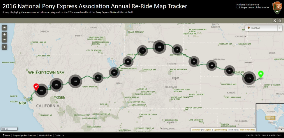
It is hard to believe that young men once rode horses to carry mail across the country in the unprecedented time of only 10 days. This relay system traveling through eight states was the most direct and practical means of east-west communications before the telegraph. Annually, members of the National Pony Express Association (NPEA), including men and women of all ages, mount their horses and re-ride history. Over the course of those same 10 days, hundreds of riders will follow the approximately 2000 mile route taken by those carrying the mail in 1860 and 1861 but will now carry along a SPOT™ satellite device in the mochila, or saddle covering that holds the mail.
Our NTIR team, working with the NPEA, tracks the mail live as it crosses the country every year along the Pony Express National Historic Trail. Our staff uses Geographic Information Systems−commonly known as GIS− applications and SPOT™ satellite pings in various ways to create interactive and real-time products that show where the riders are located. The results appear on both the Pony Express NHT website and our partner’s website at http://nationalponyexpress.org/annual-re-ride/follow-the-ride/. We also include information with customized html-encoded pop-ups about the Pony Express NHT, the expected route of the rider for those following along, and expected exchange locations along with links to more information about each. This map is used, not only by our office to educate the interested public, but just as importantly by ride captains and NPEA to track their volunteer riders day and night across the country for both safety and planning purposes. The re-ride takes place every year during the spring. This year the 38th annual ride, will take place June 5th-15th. So, take a look at the ride daily starting next week and see where the mail is!

For more information on the 2017 re-ride and the trail, please visit:
National Pony Express Association – http://nationalponyexpress.org/
Pony Express National Historic Trail – https://www.nps.gov/poex/index.htm
National Trails Intermountain Region – https://www.nps.gov/ntir